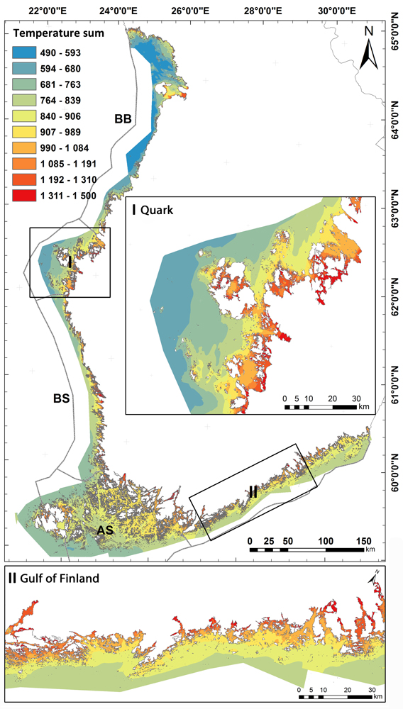
Where are the fastest warming swimming sites in the Gulf of Bothnia? Coastal temperature gradients are mapped and identified.
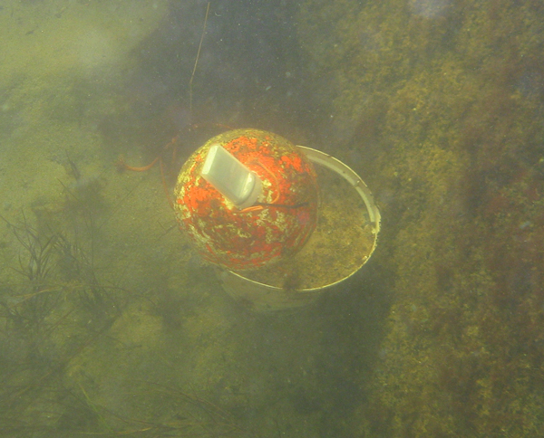
In a recent study by researchers from Natural Resources Institute Finland and University of Helsinki, spring and summer temperature development was analyzed and visualized for the entire Finnish coastal area. Small, automatic temperature data loggers were used to record water temperature in various coastal sites around the year. This data was used to model coastal temperature development in springtime across the whole coastal region. The coastal temperatures vary highly annually, the maximum recorded difference between summer and winter temperatures was over 28 °C. The high range and variability of water temperatures makes Finnish coastal areas rather challenging for many aquatic species.
Water temperature is determined by solar radiation, depth and wind exposition
Depth and exposition are the most important variables explaining coastal temperature gradients in spring and early summer when water is heated by increasing solar radiation. Deep areas warm slowly and in summertime occasional upwelling caused by wind forcing can decrease temperature rapidly. Cumulative water temperature during spring is the highest in innermost areas, lowest in open water areas and variation in daily averages was highest in the middle region of the archipelago.
Differences in water temperature level off at the end of summer
Difference in surface water temperatures between the innermost and outermost coastal areas diminish at the time when cooling begins in August -September. Differences in cumulative temperature from inner to outer coastal areas are largest in early summer and the cumulative water temperature sum differs more within coastal area than between the basins like Archipelago Sea and Bothnian Bay. For example, in innermost coastal areas the cumulative temperature sum from ice-break up to July is over twice that in the open water area. The cumulative temperature sum can be used to classify coastal areas into biologically relevant coastal regions.
Temperature sum map layer extends to species distribution modelling and estimation of potential causes of climate change for fisheries
Spatial knowledge of cumulative water temperature can be used to model and predict spatial distribution of aquatic biota, like fish reproduction areas studied in VELMU -project. The data will also help evaluation of possible causes of larger scale climatological changes in a biological context, including productivity and extent of fish reproduction areas. For example, pikeperch favors warm areas for reproduction and extent of suitable spawning habitats for it are likely to increase in the future. At the same time, reproduction of whitefish in the southern Gulf of Bothnia is predicted to suffer from high winter temperatures. In the SmartSea project we use this kind of basic data to estimate influences of environmental changes for purposes of marine spatial planning.
Article
Veneranta, L., Vanhatalo, J., & Urho, L. (2016). Detailed temperature mapping – Warming characterizes archipelago zones. Estuarine, Coastal and Shelf Science, 182, 123-135.
Lari Veneranta, Jarno Vanhatalo
Articles
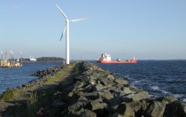
Pohjanlahti merituulienergian tuotantoalueena
Konteksti Merituulienergian laajamittainen rakentaminen on keskeinen askel Suomen tavoitetta hiilivapaaksi yhteiskunnaksi. Suomen merialueista erityisesti Pohjanlahti tarjoaa hyvät olosuhteet energian tuotannolle,
Scientific Articles published in SmartSea
One of the products of the SmartSea are the various scientific articles published by our partners during the project. The
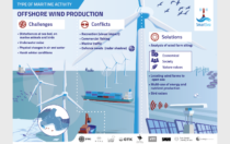
SmartSea Infographics
Offshore wind production, Aquaculture, Fisheries, Blue Well being, recreation and tourism have been key areas of the SmartSea project. We

SmartSea Final Seminar/Loppuseminaari 8.6.2021
SmartSea will hold a Final Seminar on the results of the project, and a discussion with stakeholders and affiliates on